As with much of New England High Country, Tenterfield is in granite country. The landscape is punctuated by spectacular boulders, outcrops and formations that you can get up close and personal with by exploring the area’s many national parks. But if you’re pressed for time and would like an easy way to get into the thick of it, the Mount Mackenzie Drive is for you.
It takes just an hour in total – a bit longer if you stop for a picnic at the top. You should, since the view is nothing short of stunning and there are barbecue facilities and picnic tables available.
Where
Depart the Visitor Information Centre (157 Rouse Street, Tenterfield) and head north, pass the Bruxner Highway turnoff and turn left at Molesworth Street. This road continues out of Tenterfield as Sunnyside Loop Road, which you follow in its turns until you reach the junction with Kildare Road after 8km, which you turn left into.
Approximately 2km on is Doctor’s Nose, a granite outcrop that’s remoured to be named for either its pointy shape or for a time when station hands were helping to locate a flock of missing sheep that ended up being “right under the Doctor’s Nose” (very close by). This is 1115m above sea level, and can be seen from the town when looking west.
Small Bald Rock looks like a mini version of the largest granite monolith in Australia, named – you guessed it – Bald Rock, which is located 35km northeast of Tenterfield, a National Park adventure in its own right.
A steady climb takes you to the top of the ridge. The view in the distance is the Mole River District.
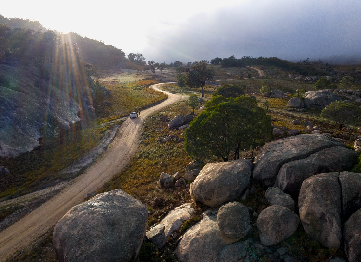
The next point of interest is Draining Rock on the right-hand side. This is one of the largest exposed granite rocks in the district, second only to Bald Rock.
Further down the road, you can see the border town of Wallangarra and the mountain ranges of southern Queensland away to the left. Another 500m along a small balancing rock and close by, between two hills, you can enjoy a view of the Tenterfield township.
Back on the blacktop, proceed just 20m to Gum Flat Road and turn right to Mount Mackenzie Lookout. Continue for 1.5km then turn left over the ramp. Proceed 3km to the top of the mountain.
At the top of Mount Mackenzie – 1298m above sea level – staggering views await. You can see not only the town of Tenterfield and the Great Dividing Range beyond, but right across the border into southern Queensland. Look for the rock on top of a mountain, just before the edge of the tableland drops into the Cataract River – this marks Woollool Woolloolni Aboriginal Place, which is located within Basket Swamp National Park.
The return trip to Tenterfield is on sealed roads and you’ll catch glimpses of the town as you descend back down to its level.